Project Overview
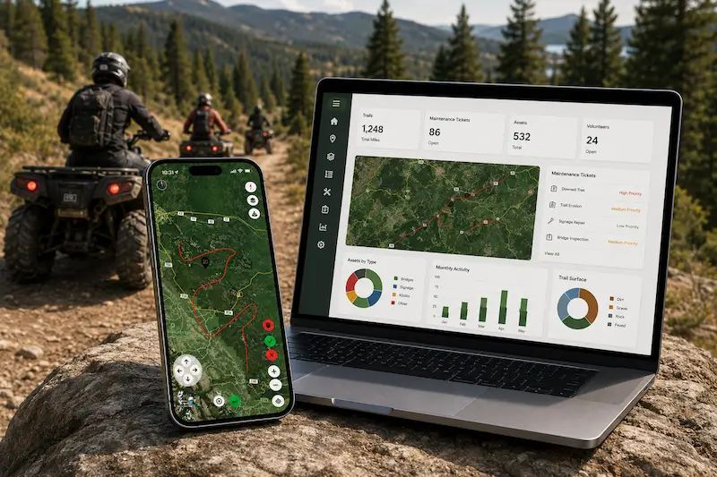
Digital Fractal developed a GIS-based mobile and web solution for a nonprofit organization responsible for managing off-highway rural trails used by both motorized and non-motorized vehicles. The platform was designed to help field teams manage trails, create new trails, and record maintenance and reporting activities directly from the field.
The solution was built using cross-platform technology and included offline capability, allowing staff to continue working in remote areas with limited or no connectivity. In addition to application development, Digital Fractal provided hosting, security, maintenance, and ongoing support.
Business Case
The organization needed a better way to manage a large and growing trail network while improving visibility into trail conditions, maintenance activities, and asset inventory. Its existing processes made it difficult to efficiently capture field data, track work completed, and maintain accurate records across dispersed trail systems.
A key requirement was the ability to support both operational management and external reporting. The organization needed a system that could provide meaningful reporting to government agencies on trail usage, maintenance costs, field activity, and ongoing stewardship efforts. Because many trails are located in remote areas, the solution also had to function reliably offline and synchronize data when connectivity became available.
The Solution
Digital Fractal developed a lightweight but scalable cross-platform application with robust GIS functionality and offline capability. The platform enables field teams to track, trace, and document trails while capturing maintenance issues and reporting activities directly from mobile devices.
The solution included:
- Trail management tools to manage existing trails and create new ones
- Offline mobile functionality for remote field use
- Integrated maintenance and reporting workflows for field personnel
- Ticketing and asset management to record issues, maintenance tasks, and trail-related infrastructure
- GIS mapping capabilities to visualize and manage trails with location-based data
- A content management system / web dashboard so organizational leaders can review operational data, maintenance history, assets, and reporting metrics
The application was optimized for mobile use while being capable of handling very large GIS datasets, making it practical for day-to-day field operations as well as long-term trail oversight.
Conclusion
The result was a modern trail operations platform that gave the organization a more reliable and efficient way to manage off-highway trail networks. By combining offline mobile access, GIS-based mapping, asset management, maintenance tracking, and centralized reporting, the solution improved both field execution and administrative oversight. With hosting, security, maintenance, and support included, the organization gained a scalable and sustainable system for managing trails, documenting work in the field, and reporting to stakeholders and government agencies with greater accuracy and confidence.