
Projects Overview
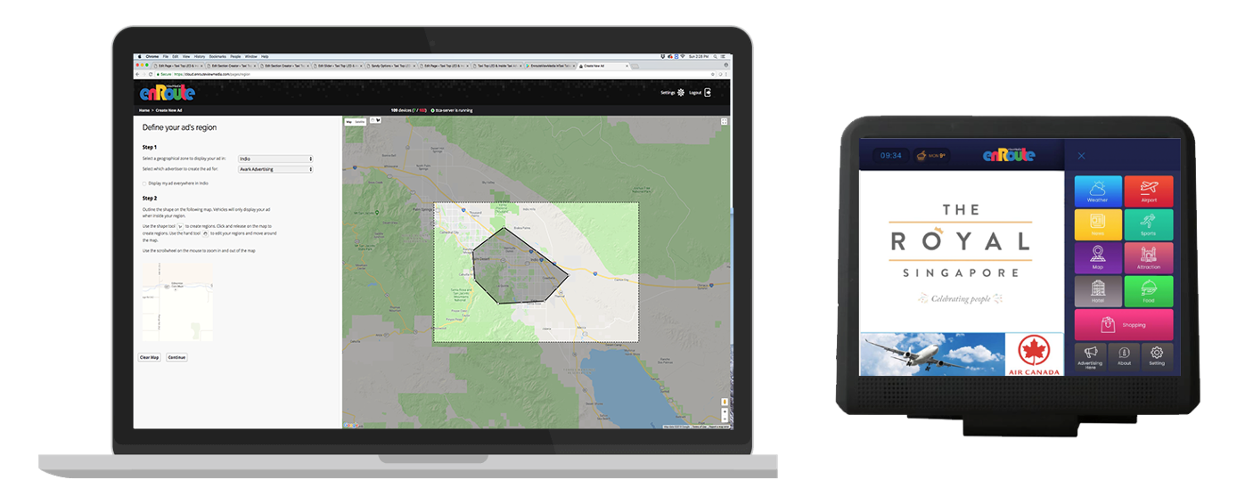
DigiStreamView is a web based digital taxi top LED screen billboard and in taxi tablet ad management system designed for moving billboards that are installed on Taxi Tops, or within the interior. The solution is complete with a customized LED controller and Android tablet software. The solution also contains a web based content management systems for geo-targeting, scheduling, tracking and reporting.
DigiSteamView helps taxi companies, rideshare companies and fleet owners to monetize their vehicles.
DigiStreamView is a SaaS based content management system compatible with Xixun Y60 and E30 family of LED controllers running Android operating systems, as well as touch screen Android 8.1+ tablets.
Advertisers are able to upload their ads directly for approval through a map based web interface.
- Moving Billboard Management Software
- Compatible with Xixuan LED controller cards
- LED Taxi Top Screen Hardware and Software Systems
- Integration with Programmatic SSP/DSPs
- Fleet Management, Customer Portals and more
DigitStreamView Full Features
- Cloud based system
- Full administrator management portal
- Agency management portal
- Advertiser management portal
- Fleet Management Portal
- Payment management
- Crowd measurement and attribution
- Map based interface to draw geo-fences
- Upload and schedule ads
- Device management page and device tracking
- APIs Integration
- Integration with Programmatic
For more information on our Canadian made Taxi-top LED screen management system, please visit http://enrouteviewmedia.com
Working Process
Research
Hardware research, hardware design, software design

Development
Software testing, integration with programmatic, development for Android and FPGA LED Controller card Xixuan.

Deploy
Deploy software to hardware and on cloud in a production environment
Conclusion
Digital Fractal developed a SaaS product for an Edmonton startup in the DOOH space, that would allow their customers to manage mobile screens inside vehicles and their rooftops. Complete with a web based management platform, integration with SPPs, DSPs, Programmatic platforms, reporting, payment and more.
-
Client:
Enroute View Media
-
Location:
Canada
-
Project Type:
DOOH, Startup
-
Duration:
12 Months